Chateau d'Urfé was built, like many other chateaus, in the 12th century. It was started around 1130 by Arnoud d'Urfé and was born of rivalries between the Count of Forez, the Sire of Beaujeu and the Bishop in Lyon. The area was also involved in the 100 Years War when the English allied with the Bourbonnais against the monarch in Paris. It was enlarged to be more comfortable in the 16th century, as chateaus were out of date with military technology and power had consolidated under the king by that time. The chateau was inhabited until about 1790 and the time of the French Revolution, when neighbors started to dismantle it and use the stones to build other structures.
The Association for the Preservation of Chateau D'Urfé does a good job of bringing in people as visitors and also for public events, like the tango concert and dance performance fundraiser below.
The Association also organizes summer volunteer work camps, in connection with the French organization Rempart which has two work sessions per summer to do restoration projects.
At 927 meters of altitude, Chateau D'Urfé has views over the Loire Valley (to the Alps on a clear day) and to the volcanic domes of Auvergne to the west seen in the sunset below. It lies at the intersection of three provinces/ Forez-Roannais; le Bourbonnais, and l'Auvergne.
Above, Alan walks by the retaining wall on the left that was built in 2011;
He is going to inspect the scaffolding, below, where there is renovation of a rempart wall built possibly in the 1400's. Below, Médi and Elise are rebuilding the upper part of this ancient wall.
The pictures below are of Arnoud placing a large boulder that will be the first step in a stairway leading up to the retaining wall shown in the first photo above.
The chateau was used from the 1100s to the 1700s and was partially dismantled after that. Wind and water erosion have taken a toll and vegetation also breaks down the stone walls. There are many different renovation projects that have been done. Many more remain.
Norbert at the center above, is a professor who gives the group periodic history lessons.
There are periodic outings, lots of work; and times when everyone collapses; below.
Rieg has been the boss for the three years that we have volunteered at Chateau D'Urfé.
He is a master mason, a good teacher, and very much of an acrobat.
Below he perches on the edge of a wall that is 20 meters above the ground.
Above Rieg gives pointers to a young mason.
Below, Rieg carries mortar made with limestone and sand up to the scaffolding where two volunteers are rebuilding a wall.
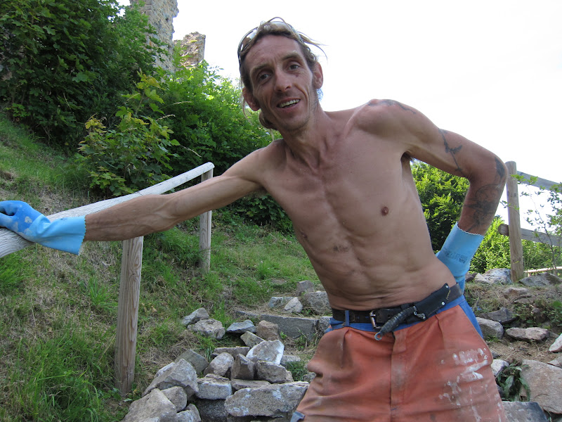
2012 was Alan's third year to volunteer at Chateau D'Urfé.
He chose two tasks: to find good stones in surrounding fields for repair work and to clear a wall from the sixteenth century of the ivy vines covering it.
The first thing that Alan did was to scour the fields surrounding the chateau to look for large squarish stones that could be used to renovate crumbling walls at the chateau.
A neighbor lent a four-wheeler to transport what turned out to be over 3,000 kilos of rocks!
The second herculean task that Alan selected was to remove ivy vines from a massive wall built in the sixteenth century. It is a right angle wall about 30 meters in total length and 10-15 meters high. The ivy vines seem to have been growing since the sixteenth century too!
This is how Alan felt at the end of each day:
Cervières is a village just off the A89 autoroute, just near the NW border of Rhone-Alpes and Auvergne. It had a grand chateau from 1170 till 1634, when it was destroyed by the King of France as a threat to his authority.
Cervières was important as a trading town and stop for pilgrims on the way from Lyon to the Atlantic Coast along a route that was created by the Romans in Gaul.
Until the 1600s, Cervières was a wealthy and important town with up to 1000 inhabitants.
The windows above are carved in granite and date back perhaps to the 1400s or 1500s.
The village today has less than 100 inhabitants, many second homes. It has many flowers and gardens.
The town was surrounded in medieval times completely by walls and towers.
Today all that is left are the arches that were the original gates.
The arch gate shown above looks southeast back to Mt D'Urfé and the Chateau above Champoly.
When we finished the hike at Lac Leman/Lake Genva/Genfersee, storm clouds were rolling in.
These pictures were all taken in the space of an hour or two as the storm passed and the sun set.
This was the last day of hiking, up and over two cols.
The ground was still wet from recent rains...
THis picture is the last Col (du Bise) and you can see Lake Geneva in the background.
The lake was our destination.
From the Col de Bassechaux at 1800 m down over 1000 m...
Alan below looks back at the mountains of Sitzerland.
Another great dinner, this in Chappelle D'Abondance.
This area of Switzerland has skiing and cows. It is acessible to Geneva and France and not so easily to the rest of Switzerland. We hiked through to get to our end refuge for the day as bad weather was threatening.
The Refuge de Haut Bise was a welcome sight for many reasons.
The meals were the best we found and the proprietors charming.
I liked them so much their pictures are posted twice, see next chapter!
Georges, above, is a French school teacher hiking the GR5 and camping. He has a lot of equipment.
The two Dutch people below hiked from Amsterdam and are heading to the Mediterranean.
This area has many ski slopes; some are open for summer business to mountain bikers.
Veronique and Jean Pierre Crépy, below, do a wonderful job running a restaurant and hostel at Col Bassechaux. http://www.crepy.net/ Best food we had on the GR5!
Irish couple below out for a pleasure hikem even though the man leads tours for American company Wilderness Travel.
Refuge Le Chardonniere is really a summer alpage for 36 cows, with a little hostel added.
Most of the food is cheese.
This area is called "Terre Maudite" or cursed land. The limestone cliffs are lower and more rounded than areas to the south; but still glaciated. This is in the headwaters of the river Dranse de Morzine and is close to border with Switzerland.