On a brilliant morning, we leave the glacial outwash plain south of Mt Blanc massif with a French hiking group from Dijon, Mille-Pat.
We leave the French hiking group at the Col de la Sauce and hike on along the Crete des Gittes, below. We are here above 2500 m and you can finally see the base of Mt Blanc in the distance with the summit hidden by clouds.
18 km; 700 m ascent and 1080 m descent.
After a long day of hiking on day 6, we were delighted to find a lovely small refuge with good food from the region. Three types of local cheese above after dinner: Tomme, Robuchon, and Beaufort.
The sunset was glorious after an afternoon of clouds and rain.
The next morning dawned clear and we had breakfast with a French hiking club from Dijon.
Gite dAlpage de Plan Mya; LEtraz, 73270 Villard sur Doron; www.refuge-mya.com
Run by Francoise and Yvon Bochet
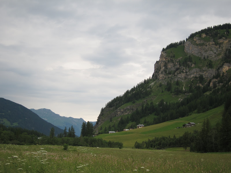
We left the valley of the Isere River and climbed up to the north to the Col du Bresson.
We started at about 1200 meters and walked slowly up through alp meadows of cows.
First the trees end, then the alp vegetation. Above 2000 meters, it is alpine vegetation up, here to the Col Bresson at 2469 m.
22 km; 1434 m ascent and 874 m descent
An alp meadow, with yellow Foxglove and Red Clover, above. About 1700 m.
Yellow Gentian and a Vetch below.
At a slightly higher altitude, mountain pine above surrounded by a vetch.
A natural rock garden of sedums below.
The Refuge de Rosuel is in the valley of Peisey-Nancroix, below, which is near Bourg St Maurice in the watershed of the larger Isere river.
This day was basically crossing from the south side of the Isere valley to the north side. Still, we were very happy to find the nice Auberge Le Valezan, with dinner below.
20 km; 521 m ascent and 837 m descent.
End moraine, above.
Side moraine and hanging valley below.
Uneven ground below is the vegetated surface of rocky till that was left as glacier deflated.
Boulders left by the glacier, above, and below.
There is no glacier left in this valley now; only the evidence of past glacial action.
The town of Tigne, above, is a ski development project tied to a large dam.
There are many small clusters of condominiums and ski facilities, all fed by electricity from the dammed river project.
Ivan, above, is a young American man hiking the GR5 and camping.
Near the Col du Palet, below is at 2652 meters.
The valley below Col du Bresson also has ski resorts of Peisey-Nancroix and Villandry.
There are many glacial features in the valley, see chapter above.
17 km; 552 m ascent and 1100 m descent.
We had reached the Refuge du Col de la Vanoise in the fog; on the next day the clouds had parted and a beautiful high mountain landscape was visible, above 2,500 meters.
This is the French National Park de la Vanoise, the first (created around 1960) and it gets a lot of visits by French hiking groups. Below, the beautiful valley leading up to Col de la Leisse at 2758 meters.
The Col de la Leisse had much late lying snow.
Day 3 was 21 km, with 659 meters of ascent and 1073 meters of descent.
We left German hikers at the refuge, 1,911 meters and headed up into the mist.
This route is an old trading road going back to Roman times, for carrying salt up into Europe.
This days weather deteriorated so that at the spectacular Col de la Vanoise (2517 meters) we could see nothing.
The north side of the Col de Chaviere had loose talus boulders and a lot of snow.
The trail was hard to follow and we were cold.
Even with discomfort, there were beautiful scenes, and a refuge at the end of the 20 km hike.
This day was over 20 km, with 1750 meters of ascent and 950 meters of descent.
Too much for the first day!